
Part I of 6 · SSRC-INF-IIFF-v2.0 Report
The signal and how it becomes extreme
The misleading average and the alignment of layers that produces the extreme episode.
01 · The Signal
The average is misleading when a minority concentrates destruction
There were 8.199 incidents compared to 9.171, and yet the affected area went from 105.614 hectares to 354.746,67 hectares, with 63 large forest fires compared to 24.
The interpretation is direct: fewer incidents do not mean a smaller problem. Destruction is concentrated in a minority of episodes, so the total number of fires does not describe the severity, and the average hides precisely what matters.
Distinguishing the ordinary fire from the episode that overwhelms response capacity is the prerequisite for discussing prevention, land management, and population protection without confusing volume with severity.
V1 · Auditable visual
Fewer incidents, more burnt area
Message: The average is misleading: with fewer incidents, much more surface can burn because a minority of episodes concentrate destruction.
Incidents
number of incidents
- Analyzed
- 0
- Reference
- 0
Burned area
hectares
- Analyzed
- 0,00 ha
- Reference
- 0 ha
Large fires (GIF)
episodes of 500 ha or more
- Analyzed
- 0
- Reference
- 0
- Incidents
- 0versus 0
- Burned area
- 0,00 haversus 0 ha
- Large fires (GIF)
- 0versus 0
What it demonstrates — and what it does not
What it demonstrates
That the number of incidents and the burned area can move in opposite directions, and that large forest fires concentrate the damage.
What it does not demonstrate
It does not explain by itself why this concentration occurred, nor does it attribute the result to a single meteorological, territorial or operational variable.
- Source
- MITECO, forest fire statistics and Strategic guidelines for forest fire management.
- Editorial date
- August 2026 edition
- Level of evidence
- A
Alternative text: Gráfico V1: comparación entre dos periodos con menos siniestros y, al mismo tiempo, más superficie quemada y más grandes incendios forestales; 8.199 siniestros frente a 9.171, 354.746,67 hectáreas frente a 105.614 y 63 grandes incendios forestales frente a 24.
V1.b · Auditable visual
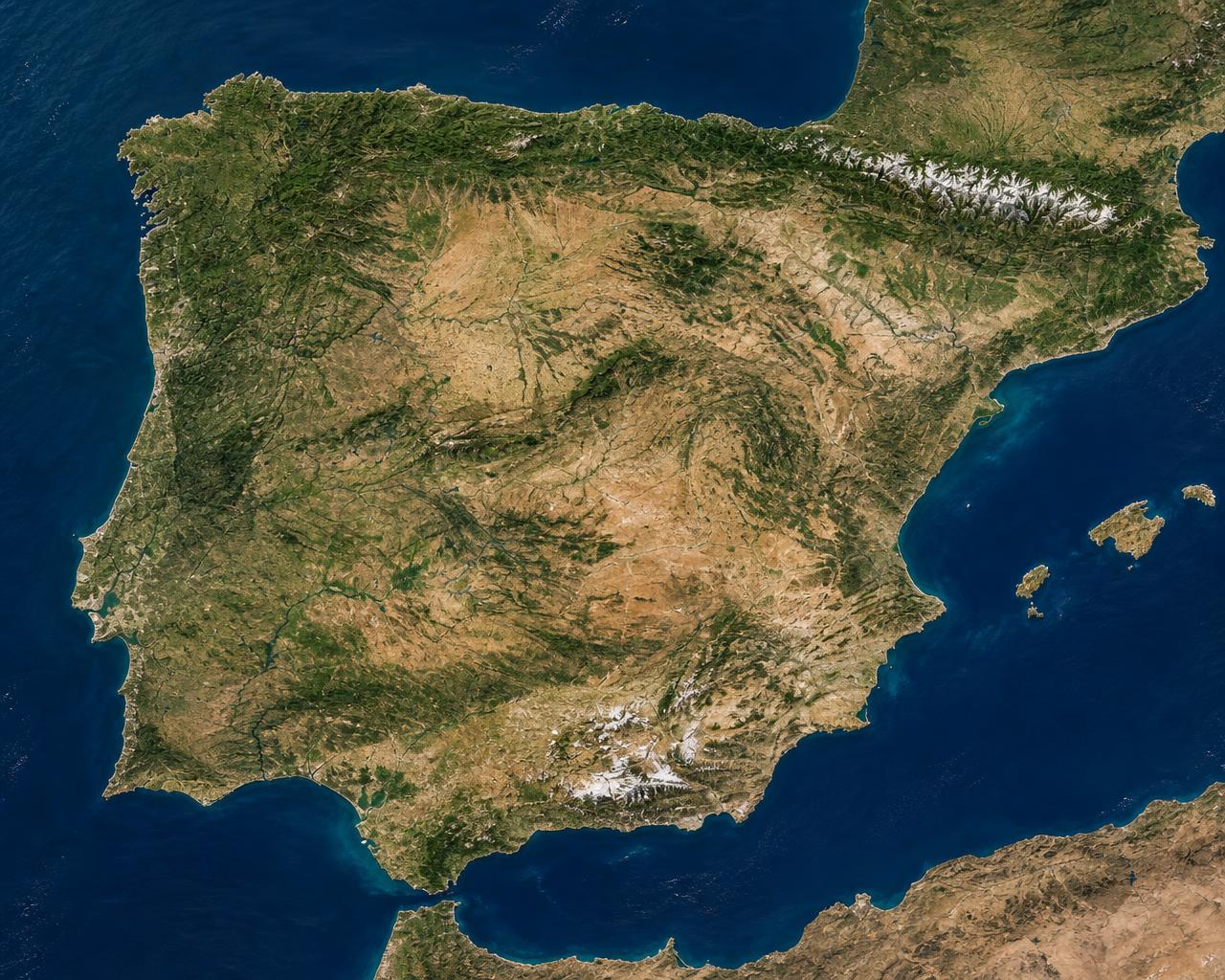
Fire X-ray: 63 versus 24
Message: Large forest fires are not distributed uniformly: when they multiply, they multiply in the same hotspots.
Territorial comparison of large forest fires (more than 500 hectares). The size of the point is constant: what changes between the two scenarios is the density on the same hotspots.
Scenario A · high incidence
63
Concurrency of episodes that simultaneously pressures firefighting resources and forces prioritization of the protection of people and assets.
Scenario B · moderate incidence
24
Same territorial hotspots with lower density: the deployed resources can sequence the response without critical overlapping.
Escenario A
63LFF > 500 ha
Canary Islands
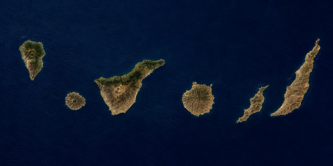
63 large forest fires. Saturation is concentrated in the Northwest and extends to the Iberian System, the Mediterranean axis, and the Canary Islands.
Escenario B
24LFF > 500 ha
Canary Islands
24 large forest fires. The territorial pattern is the same; what changes is the number of coincident episodes in time.
- Scenario A · 63 LFF
- Scenario B · 24 LFF
- LFF: forest fire of more than 500 hectares.
Peninsular Northwest
Galicia, Asturias, León and Zamora
Highest density of large fires and affected area in official series; concentrates the episodes of greatest extent.
Iberian System and Catalan Coastal Range
Zaragoza, Teruel and Castellón
Continuous masses in territory with low population density and episodes associated with heatwaves and accumulated dryness.
Mediterranean Axis and Andalusia
Valencia, Granada and Malaga
Wildland-urban interface: the exposure of homes, infrastructures, and people conditions the response from the outset.
Canary Archipelago
Tenerife and Gran Canaria
Fewer incidents out of the national total, but steep slopes, accessibility, and vertical continuity elevate the severity of the episode.
The critical factor
A minority of episodes accounts for most of the burned area in a year. That is why the total number of incidents does not describe the severity: the useful indicator is how many episodes simultaneously exceed response capacity and where they do so.
Estimates on the percentage of large fires with direct impact on people, homes or property and on the intervention of state resources are not published in this visual: they are pending documentary verification in official sources before their incorporation.
What it demonstrates — and what it does not
What it demonstrates
What it does not demonstrate
- Source
- MITECO · General Statistics of Forest Fires (EGIF); territorial reference distribution of official series.
- Editorial date
- August 4, 2026
- Level of evidence
- B · Distribución territorial orientativa
Alternative text: Infografía V1.b: dos mapas de relieve de la península ibérica, Baleares y Canarias comparados. En el escenario A se representan 63 grandes incendios forestales de más de 500 hectáreas y en el escenario B, 24. En ambos casos la mayor concentración de puntos se sitúa en el noroeste peninsular (Galicia, Asturias, León y Zamora), seguida del sistema Ibérico y la cordillera costero-catalana (Zaragoza, Teruel y Castellón), el eje mediterráneo y Andalucía (Valencia, Granada y Málaga), el interior peninsular y el archipiélago canario, representado en un recuadro menor en la esquina inferior izquierda de cada mapa.
02 · How it becomes extreme
The extreme fire does not have a single cause
Ignition starts the problem, but disaster appears when meteorology, fuel, terrain, and human exposure align. The 30-30-30 rule retains value as a warning, although it does not replace the actual fuel moisture, previous dryness, soil, vegetation, or topography.
Solar radiation can quickly heat and dry fine fuels. UV-B radiation should not be presented as a direct drier: combined with heat, drought, water deficit, and other stressors, it can contribute to plant stress and senescence, increasing dead leaves and twigs and available continuity. On slopes, fire preheats the fuel above; pinecones, branches, bark, and other ignited fragments can roll and open new ignition points below.
“The thermometer measures the air; fire finds the real temperature and humidity of the fuel.”
Editorial review
The 30-30-30 rule warns; it does not diagnose the local danger or fire behavior by itself.
Visual family of chapter 02
Three linked visuals: the layers of risk (V2), their physical expression on the slope (V3), and the transition from warning to diagnosis (V10).
V2 · Auditable visual
The four layers of risk
Message: Extreme damage appears when all four layers align; they are not four isolated causes.
- 1
Ignición
Human origin —accidental, negligent or intentional— or natural. Intentionality is not equivalent to pyromania: these are distinct categories.
- 2
Meteorología y sequedad
Temperature, relative humidity, wind, accumulated rainfall and previous water deficit.
- 3
Combustible y territorio
Quantity, horizontal and vertical continuity, actual fuel moisture, soil, vegetation and management.
- 4
Exposición
Population, housing, infrastructure, evacuation capacity and values at risk.
Extreme damage appears when the layers align.
What it demonstrates — and what it does not
What it demonstrates
That extreme fire is explained by the chained interaction of ignition, atmospheric conditions and dryness, fuel and territory structure, and exposure of people and property.
What it does not demonstrate
It does not establish numerical weights between layers, it does not predict the behavior of a specific fire, and it does not allow attributing extreme damage to a single variable.
- Source
- AEMET (IPIF 2026); MITECO, Strategic guidelines for forest fire management.
- Editorial date
- August 2026 edition
- Level of evidence
- A
Alternative text: Infographic of four chained blocks —ignition, meteorology and dryness, fuel and territory, exposure— linked by connectors indicating that they act dependently; a lower band indicates that extreme damage appears when all four layers align.
V3 · Auditable visual
From the ground to the canopy
Message: Fire changes stratum when there is vertical continuity of fuel; roots are not a universal ladder to the canopy.
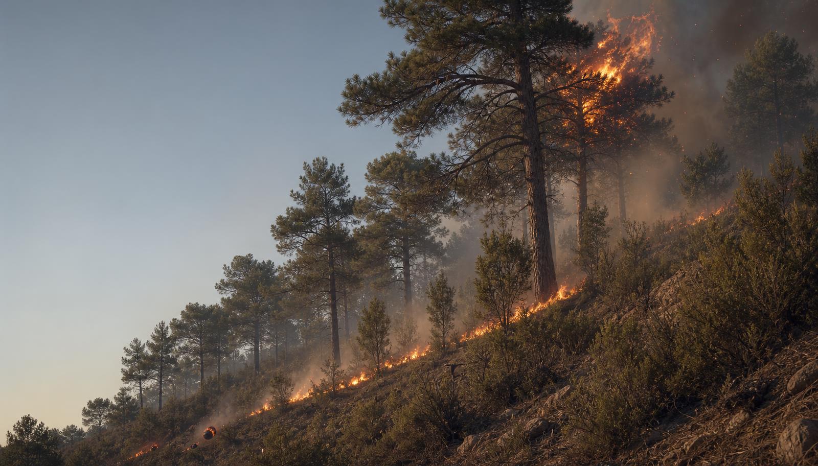
Slope cut: fuel strata
The change of stratum requires vertical continuity, not an ascent through the roots.
- 1
Fuego de suelo
Slow combustion in organic matter and surface horizons; can persist without visible flame.
- 2
Fuego de superficie
Advance through leaf litter, grass, low scrub and dead twigs.
- 3
Combustibles de escalera
Tall scrub, live or dead low branches and regeneration that connect the surface and canopy vertically.
- 4
Fuego de copas / dosel
It spreads through the upper part of the trees when vertical continuity and conditions allow it.
- 5
Pavesas y focos secundarios
Burning particles carried by the column and wind; can start spot fires at a distance.
- 6
Materiales rodantes
Burning pine cones, branches, bark and fragments that roll downhill and create new fires below.
Explicit correction: there is no such thing as a “root fire that climbs” into the crowns. There can be persistent underground combustion in soils with organic matter, but roots do not function as a universal ladder to the canopy: the leap to the crowns depends on the vertical continuity of aerial fuel and environmental conditions.
What it demonstrates — and what it does not
What it demonstrates
That the transition to crowns depends on the vertical continuity of the fuel and environmental conditions, and that embers and rolling materials can start fires above and below the front.
What it does not demonstrate
It does not quantify speeds or jump distances, it does not provide universal propagation multipliers, and it does not describe a “root fire” that ascends through the tree.
- Source
- MITECO, Strategic guidelines and preventive actions BLP; Fire Ecology (2020), radiant heating, drying and flammability of litter.
- Editorial date
- August 2026 edition
- Level of evidence
- A
Alternative text: Realistic illustration of a sloping forest hillside with six numbered elements: 1 ground fire in organic matter, 2 surface fire in litter and low scrub, 3 ladder fuels connecting vertically, 4 crown fire in the canopy, 5 embers rising from the column and generating secondary foci, and 6 ignited materials rolling downhill. A note clarifies that there is no root fire that climbs the tree to the canopy.
V10 · Auditable visual
Beyond the three 30s
Message: The three 30s warn; the territory and integrated indices allow for diagnosis.
Mnemonic sign
The three 30s
- 30°CTemperature
- <30%Relative humidity
- >30km/hWind
Useful and memorable warning. Starting point, not diagnosis.
Atmosphere and water
- Incident solar radiation
- Accumulated dryness and previous rainfall
- Soil moisture
Fuel
- Real fuel moisture
- Vegetation status and type
- Horizontal and vertical continuity
Territory
- Aspect, slope, hour, shade and cover
- Local microclimates
- Roadsides, corridors and rolling stock
The three 30s warn; the territory and integrated indices allow for diagnosis.
What it demonstrates — and what it does not
What it demonstrates
That the three 30s mnemonic works as a warning sign and that the diagnosis of danger requires atmosphere, fuel and terrain variables integrated into indices such as the IPIF.
What it does not demonstrate
It does not convert the three 30s into an operational index, does not set decision thresholds, and does not claim that UV radiation directly dries leaves.
- Source
- AEMET, Forest Fire Danger Index 2026; MITECO, Strategic guidelines.
- Editorial date
- August 2026 edition
- Level of evidence
- A/B
Alternative text: System infographic. To the left, the mnemonic signal of the three 30s: 30 degrees Celsius, relative humidity below 30 percent, and wind exceeding 30 kilometers per hour. To the right, three groups of variables that expand the diagnosis: atmosphere and water (solar radiation, accumulated dryness and rain, soil moisture), fuel (actual fuel moisture, state and type of vegetation, continuity), and territory (orientation, slope, time, shade and cover, microclimates, ditches and corridors with rolling materials). A final strip indicates that the mnemonic warning does not replace integrated indices.
End of chapter 02
If extreme fire arises from the alignment of layers, the next question is not meteorological but territorial: what was in the forest, in the accesses, and in the homes before ignition occurred.
Continues in 03 · The territory before the fire